Saturday, September 20, 2014

Digitizing Tékumel - Part 4: Detailing the Mssúma River


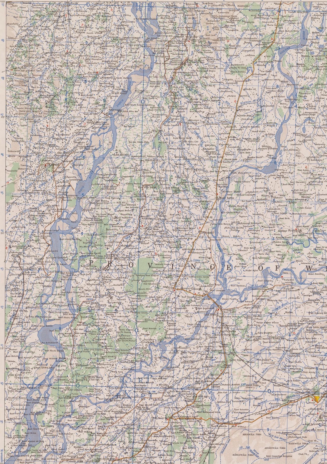
I've started to make a first attempt at detailing the Mssúma river. My personnal opinion is that, in character, it would be much like the Indus, Ganges and Brahmaputra rivers that flow through India, Pakistan and Bangladesh. I believe that the background material describes it as wide and slow moving, and filled with the yellow silt. We know that at least part of the region is subject to monsoon like rains so I am assuming that the rivers of the region are subject to floods and that their paths probably change over time as the river cuts a new path. 

If you examine the maps of the India, Pakistan and Bangladesh region that I linked to in my previous post you will see that the cartographers have noted that the rivers are subject to change. They also seem to indicate the typical "high water" boundaries of the rivers, though again that could potentially vary from year to year. My intent is to draw my version of the Mssúma river in the same manner.

A couple of things need to be decided upon. For example, width. I have traced the approximate centerline of the river as it appears on the Swords & Glory map. I did this as far north as Avánthar so far. I stopped because I had forgotten which branch was the Mssúma river. It seems that the right-hand branch is the river but I haven't gone back and added that bit. When I do I will be able to estimate the length of the river and compare it with real world examples.

The first thing I did was to offset the centerline on each side in one kilometer increments. This was so that I could get an idea of the river at various widths. I think I stopped at 5 kilometers total. You can see how it compares to the width of the line used to describe the river on the original map.

Then I used an AutoCAD tool called a spline to draw a curved line to represent a first attempt at each river bank. The intent is to add to this or modify as seems appropriate, adding or removing curves or changing the character so that it resembles the Indus river I showed in my last post. I am going to allow the original line to offer hints as to where islands and lakes might be located. Or perhaps allow it to indicate the extent of the river in a normal flood year.


This clip shown above shows the river in the region of Metlán and Jáyo, two small cities I invented. It just seemed to me likely that where the Sakbé road crossed the river there would be some sort of human habitation. I haven't done much to expand my initial descriptions of the cities but you can find my first stab at it here


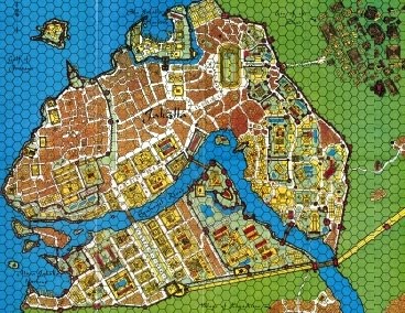
This next picture shows Tsolyánu with a rectangular grid overlaid on it. Each grid rectangle is 200 kilometers by 150 kilometers and is sized so that it will fit on a typical B1 drawing sheet at 1:250,000 scale with plenty of room for a title block and key. I centered the grid around the immediate area about Jakálla and then expanded it from there. 


I'll also be adding the smaller tributary rivers and streams not shown on the larger map. Of course, I'll be making all that up as I'm pretty sure the Professor didn't provide any information that detailed. If you go back and look at that Mssúma river watershed picture from my last post you might notice that I have added distributary rivers at its mouth. My thinking is that as the river path has changed over time it is more likely to have run through the area of the Flats of Tsechélnu than it is the higher ground to the east of the river (in green on the map). I think it must resemble a situation somewhat similar (though on a smaller scale) to the Mouths of the Ganges. This can be found in detail on the maps I linked to last time.

Friday, September 19, 2014

Digitizing Tékumel - Part 3: the Mssúma River Watershed


The Mssúma River Watershed (approximate)

Continuing my exploration of Tsolyánu's geography, I have been looking at various Real World rivers in order to get a better understanding of what the mighty Mssúma River would look like up close. Shown above is the Mssúma River and its tributaries. Hopefully the bits I did with yellow highlighter are visible when you click on the pic! What I did was examine the map and try and decide where the rivers would flow from - including all the small tributaries not shown on the main maps. I drew lines to represent the high points of land such as that between the Ranánga and Eqúnoyel rivers. I also drew in some smaller tributaries just for fun.

In AutoCAD one can use polylines to enclose areas and a quick right-click look at the properties of the line will give the area enclosed. So I drew a polyline that approximately enclosed the same area outlined in yellow highlighter in the picture above. This gave an area of 1,505,289.25 square kilometers.

A quick Google search reveals the watersheds of some major RW rivers:

The Indus River: 1,165,000 sq km;
The Ganges/Brahmaputra river basin: 1.7 million sq km;
The Mississippi River: 2,981,076 sq km.

I have been looking closely at the Indus and Ganges/Brahmaputra rivers at least in part because of the time I know Professor Barker spent in the region. Shown below are some clippings from maps of the Indus river.


These I found in a collection of 1:250,000 scale maps of India and Pakistan at the University of Texas. I've downloaded all the maps and have been poring with interest over them, giving special attention to the rivers and coastal areas.


Wednesday, September 3, 2014

Digitizing Tékumel - Part 2


Here are some screenshots of the digitization process, as I've been doing it...


In the first one you see the general work area in Model Space. It's a bit cluttered because I'm trying various things. As you can see, I've traced some of the coast (as shown in my previous). Also shown are various Tsolyáni cities (the crosshairs).


This screenshot is zoomed in on the Gulf of Perudáya and Jakálla region. The coast is only roughly blocked in and I've made some first attempts to map the sandbars.


This screenshot is zoomed in again showing how the Jakálla and Pála Jakálla plans have been inserted. The converging lines that look a bit like arrowheads are keys I use so I can move the jpegs back out of the way if I want to track progress. At this point I have moved Pála Jakálla to the side and you might be able to see where I have been tracing the shoreline shown in the city plan.


Another close-up zoomed in even further. The Sákbe roads can be seen, heading east from Jakálla and down from the north to Pála Jakálla. I've drawn all three levels, but only as three lines. What I've done is offset the lines by the widths indicated in the source material. Note that this doesn't account for the wall thicknesses between the road levels. To add that I would have to work it out as I don't think the Professor ever went into that much detail.

Before blocking in the sandbanks I did a bit of research into RW examples. The Thames Estuary is a good example with tidal mudflats and sands extending out many nautical miles into the North Sea.


This screenshot is zoomed in on Jakálla. It shows how I've tried to orient the city plan with the rough trace of the coast. The rough centerline of the Eqúnoyel river comes up from the south and the Sákbe road runs east from the city.


Here I have zoomed in even farther to how the Sákbe road is drawn. The keen eyed will notice that the city plan is on a slight angle. This is because when I scanned the Swords and Glory maps I had to use a large format scanner. When they went in they didn't go through perfectly straight and I forgot to correct the image before I started using it. When I realized my error I rotated the object in CAD, which included the city plan.

I should probably rotate it back but really there is so much going to change I might not bother. You can see, for example, how the width of the Sákbe road is compared to that I've drawn. Even acknowledging that I don't show the wall thicknesses, the original city plan is exaggerated.

And that has been acknowledged for a long time. I think the Professor used to describe the plan as an artistic rendering. Indeed, the outer walls as drawn turn out to be 12 meters thick in most places. Probably what I will do is take the outer line of the walls but adjust the thicknesses to more reasonable numbers. Unless you think 12 meters is about right?  (I think the walls of Constantinople were about 4 meters thick...)


Zooming out slightly again, we can see more of the Gulf. The roughed in line of the Mssúma river can be seen top center. It heads north in a series of great curves for over 1000 kms. I will be able to tell you the exact length when I have finished tracing it. :-)

Of course, the large scale map leaves outs a lot of detail. I've been studying RW examples again, such as the Ganges river system. In my map - which I again remind you in NOT canon - the last curve will have various distributaries branching off from the river as it makes that last great curve. If you look at the first screenshot above you can see on the map scan that the Flats of Tsechélnu extend quite a ways north along the river. My assumption is that the river's course would naturally change of the passage of time and that when it dd so it would be more likely to do so in the Flats than in the higher lands (indicated in green). But more on that later.


Here is a screenshot of the Pála Jakálla area again. As I think I mentioned this city plan is to be found in the Tékumel Yahoo Group files section. It is from a campaign run by Jack Branagh Bramah (apologies for the spelling error, Jack!) and another, but I don't know who drew it. (Edit: Jack drew it!) It is used here without their his permission, but I hope they don't mind. I just happen to like their version of the city and as very little other information exists, who am I to look a gift horse in the mouth! :-)

I don't know if I have located it quite as they would have but I suspect I am using a little more precision in placing things than most, given that most people rely on the just the large scale maps.


Here is a screenshot zoomed in on the city plan with digitization in progress, using polylines to trace out the shoreline. They never gave that river a name and I am not sure if it is meant to be the Ranánga or not.


Here the city plan is moved out of the way to show progress. Tracing the more detailed city plan compares markedly with the straight lines of the rough coastal trace of the larger map.Obviously, I cannot detail every bay or inlet along the Tsolyáni coast so probably the level of detail I should be aiming for is somewhere between the two extremes.


Here it is zoomed out again to show the tidal flats. I've actually done a bit more since this screenshot. The first shot in my previous post shows some features I've added.


Here it is again. I've actually started thinking about layers and adding colours to help distinguish the features. The green circles are "places of interest". Note that I've turned that small river that runs through the Pála Jakálla plan into a subsidiary river branching off from the Mssúma river. My current thinking is that where the road crosses this subsidiary is perhaps marshy ground and that stretch of road might be wooden and up on piles such as around Pénom. This may change however - it's early days yet!

Note also the two ferry crossings. These are probably going to change. When I blocked in the coast I think I made the mouth of the Ranánga river a little too deep. So the so-called "New Ferry" will disappear and be replaced by a much smaller river crossing. The "Old Ferry" came about because the Pála Jakálla plan has a "Thráya gate/road" (can't recall which off the top of my head) and I thought "what is the point of the name if there is no connection eastward to Thráya?" And as the road goes around in a big loop I figured there must be an old ferry.

Exploring Tsolyánu - Jakálla and the Gulf of Perudáya (Digitizing Tékumel)


The above screenshot shows a bit of what I have been working on lately. It is taken from the map in the Swords and Glory boxed set and shows part of the Gulf of Perudáya. The hexes shown are 100 tsán across, or 133.33 kilometers. The map symbols show the [theoretical] location of the cities of Jakálla (bottom) and Pála Jakálla (top). The dotted lines mark the lines of the Sákbe roads. The pale yellow area is the Tsechélnu Flats which extend for hundreds of tsán to the west. The green area represents lands with higher elevations than the flats. Three rivers are shown: the great Mssúma river (also spelled Missúma) flows from the north, the Ranánga river flows from the east, and the Eqúnoyel snakes from east to west along the bottom.

What I have done is taken a scan of the Swords and Glory map, or rather a swatch taken from it showing Tsolyánu, and loaded it into AutoCAD. I then scaled the image so that I could draw in meters and kilometers. I should step back and say that I actually started with the city of Jakálla, loading an image of it which is why my units are meters. And technically I can use three decimal places to draw things less than a meter as well.

I then began to digitize both the city and the geography, tracing the maps to do this. Of course, the line representing the coast becomes many kilometers wide when I scaled up the scan so I drew an arbitrary line down the approximate center. I did the same with the rivers and roads. It doesn't really matter right now as I am just blocking things in.

At this point it can be seen that there are problems with the large map. The map symbols for the cities are shown very approximately. Below is the map of Jakálla I used. This is from the original Empire of the Petal Thrones boxed set, and is available from RPGNow for about the cost of a cup of coffee (probably less if you go to Starbucks!)


The river shown is the Eqúnoyel which as you can see flows right through the middle of the city. On the large map, however, Jakálla is shown to the east - about 20-30 kilometers to the east, as a matter of fact!

So some adjustments have to be made.

The above scan of the city should be visible in my digitized image at the mouth of the Eqúnoyel river. I also borrowed a plan of Pála Jakálla that is in the files area of the Tékumel Yahoo group.

I should note at this point that all this is very definitely not canon.